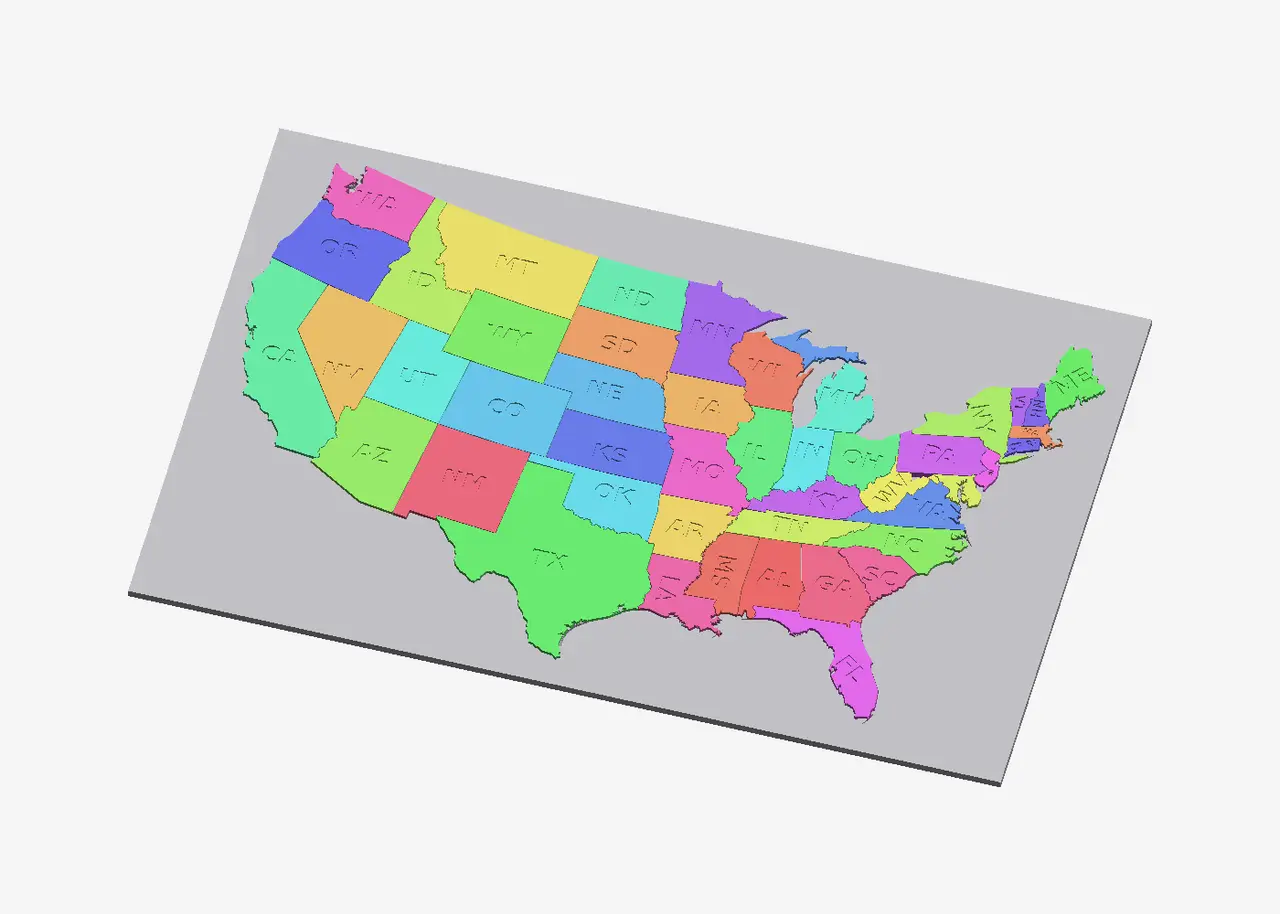
US States Puzzle (48 contiguous states) with Tray
por Jacob Müller en MyMiniFactory
US States Puzzle Map: 47 pieces with engraved abbreviations and a two-part tray
MyMiniFactory entrega los archivos a usuarios con cuenta gratuita
Licencia
Uso comercial permitidoPuedes imprimirlo, modificarlo y venderlo dando crédito al autor.
Al descargar aceptas respetar la licencia y dar crédito a Jacob Müller.
Archivos (4)
- pieces_plate1.stl STL
- pieces_plate2.stl STL
- tray_east.stl STL
- tray_west.stl STL
- Categoría
- Juguetes y juegos
- Formatos
- STL
- Descargas
- 13
- Publicado
Sobre este modelo
US States Puzzle Map: 47 pieces with engraved abbreviations and a two-part tray
A 3D-printable puzzle of the contiguous United States. Each state is its own 3 mm piece with its postal abbreviation engraved on top, and the pieces drop into a matching pocket in a tray. Assembled, the map is about 310 × 195 mm. The tray is split into a west half and an east half, so each part fits a 220 × 220 mm bed.
The state outlines are real boundaries. They come from the U.S. Census Bureau's 2025 cartographic boundary file (cb_2025_us_state_5m, public domain), projected in USA Contiguous Albers Equal Area so the relative sizes are true, then simplified for printing.
What's in the box
tray_west.stl, tray_east.stl: two 163 × 211 mm halves, 3.2 mm tall (a 1.2 mm floor and a 2 mm deep pocket). Butt them together and glue or tape the seam from underneath. Some states sit across the seam, which helps hold the halves in line.
pieces_plate1.stl, pieces_plate2.stl: all the state pieces laid out flat on two 220 mm plates. Each piece is a separate body, so you can change filament colors between plates or split them in your slicer.
preview_*.png: renders.
Pieces are inset 0.125 mm per side and the pocket is grown by the same amount, so the total fit clearance is about 0.25 mm. If your printer runs tight, scale the pieces to 99%.
Notes on small states
DC is part of the Maryland piece.
Delaware is joined to Maryland, and Rhode Island to Connecticut, as combined pieces. At this scale they would otherwise be only 3–4 mm across, too small to pick up. Virginia's tiny Eastern Shore and very small islands are left out.
Michigan comes as two pieces: the Lower Peninsula and the Upper Peninsula.
A few small pieces (MD/DE and the Upper Peninsula) have no engraved label because there isn't room.
Print settings
Material: PLA
Layer height: 0.2 mm (0.12 mm gives crisper engraving on the small Northeast states)
Infill: 20–30%
Supports: none. Everything prints flat side down, exactly as oriented in the files.
Tip: print the pieces in 4–6 colors so no two neighboring states match. Or print them all in one color and paint the engraved letters.
Using it in class
Geography drill: name each state as you place it. The pocket shows the real shape and position, so even younger kids can finish it.
Size sense: the projection is equal-area, so the pieces really can be compared. Texas is several times larger than all of New England combined.
Neighbors and regions: sort the pieces by region before assembly, or race to place every state that borders a chosen one.
Facts round: for each piece a student places, have them look up one fact about that state, such as population, median income, commute time or home values. USA State Stats works well as a companion for this: it has a free reference page for every state, built from Census ACS data, plus state rankings that turn into a good "find the top 5" game on the finished map.
Data and license
Boundaries: U.S. Census Bureau, 2025 Cartographic Boundary Files, States, 1:5,000,000 (public domain). Model released for personal and educational use.
Descripción original del autor, publicada en MyMiniFactory.