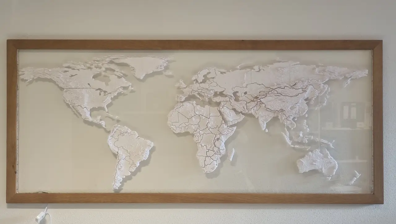
Topographic World Map
por Chrashice en Thingiverse
Explore the world in 3D with this topographic world map puzzle! This unique design includes all elevations, allowing you to feel the contours of each continent. By printing it with 100 % the world map has a size of 1800 x 750 mm. The files are conveniently sorted by continents, each with its...
Licencia
Solo uso personalCC BY-NC-SA 4.0 — Atribución, no comercial, compartir igual
Uso personal dando crédito; sin fines comerciales y las modificaciones con la misma licencia.
Al descargar aceptas respetar la licencia y dar crédito a Chrashice.
Archivos (7)
- Categoría
- Figuras y arte
- Formatos
- STL, ZIP
- Descargas (todas las plataformas)
- 28,734
- Publicado
También en
Sobre este modelo
Explore the world in 3D with this topographic world map puzzle! This unique design includes all elevations, allowing you to feel the contours of each continent. By printing it with 100 % the world map has a size of 1800 x 750 mm. The files are conveniently sorted by continents, each with its initial number for easy assembly. - Europe: 1 - Asia: 2 - Oceania: 3 - Africa: 4 - South America: 5 - North America: 6
Dive into geography and bring the world to your fingertips! For comercial usage, just send me a message. Than we will find an agreement If you want to support me. Please leave some love here and "Buy me a Beer". Thank you.
Descripción original del autor, publicada en Thingiverse.