Fuji
por Manifold en Printables
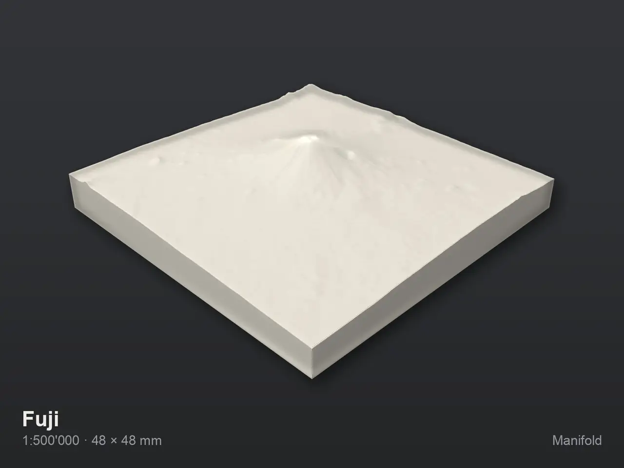
This is a 3D model of Fuji, at 1:500'000.
Licencia
Solo uso personalCC BY-NC-SA 4.0 — Atribución, no comercial, compartir igual
Uso personal dando crédito; sin fines comerciales y las modificaciones con la misma licencia.
Al descargar aceptas respetar la licencia y dar crédito a Manifold.
Archivos (2)
- Categoría
- Educación
- Formatos
- STL
- Descargas
- 0
- Publicado
Sobre este modelo
This is a 3D model of Fuji, at 1:500'000. It measures 4.8 × 4.8 × 1.1 cm and covers real terrain between 175 and 3776 m above sea level — heights are at true scale, with no vertical exaggeration. WHAT'S IN IT - Terrain from Copernicus GLO-30: 30 m source data on a 100 m model grid - Place name and scale engraved into the underside PRINTING - The model is one closed, watertight body — 120,096 triangles - No supports needed: terrain has no overhangs - 0.1–0.2 mm layers. Adaptive layer height suits relief well — fine on the ridges, coarse on the flats - Base is 4 mm thick under the lowest point - A separate drop-in frame is included: 5.4 × 5.4 cm, 6 mm tall. The model drops in from above and rests on an inner ledge — print it in a second colour IN CAD - Written in millimetres, with (0, 0, 0) at the centre of the cut-out on the underside of the base — nothing sits millions of units from the origin, so no CAD program has to round - 1 mm on the model is 500.000 m on the ground (1:500'000) - That origin is E 293,829.10 / N 3,915,645.26 in EPSG:32654, with the base plane at -1,814.60 m above sea level - To georeference it again: multiply the millimetres by 500.000 to get metres, then add that vector DATA Built from open geodata: - Copernicus GLO-30 (terrain) This data is free to use, including commercially, and derived works may be shared — provided the source is credited: © Data: Copernicus DEM — produced using Copernicus WorldDEM-30 © DLR e.V. 2010–2014 and © Airbus Defence and Space GmbH 2014–2018, provided under COPERNICUS by the European Union and ESA · Place names © OpenStreetMap contributors (ODbL) © Map image: Terrain Light by EOX — data © OpenStreetMap contributors (ODbL), rendering © EOX Made with Manifold, which turns open geodata into printable models.
Descripción original del autor, publicada en Printables.