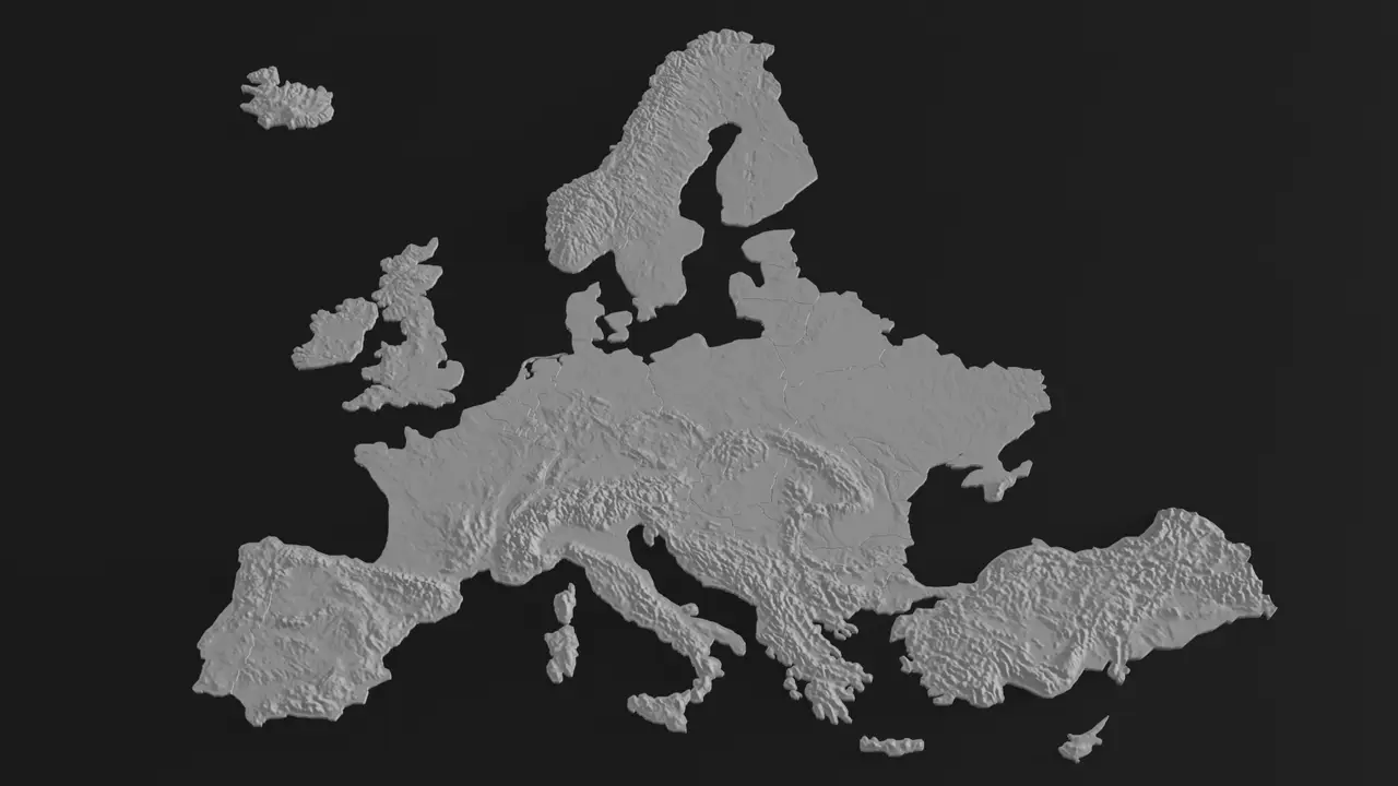
Europe 3D terrain (topography) model
por malenma3 en Printables
Topographic 3D models of (almost) all European countries.
Licencia
Solo uso personalCC BY-NC 4.0 — Atribución, no comercial
Puedes imprimirlo y modificarlo para uso personal dando crédito. No se permite vender las impresiones.
Al descargar aceptas respetar la licencia y dar crédito a malenma3.
Archivos (50)
- Europe.stl STL · 35,2 MB
- Italy.stl STL · 1,5 MB
- Czachia.stl STL · 561 KB
- France.stl STL · 2,8 MB
- Germany.stl STL · 1,7 MB
- Spain.stl STL · 2,5 MB
- Great_Britain.stl STL · 1,5 MB
- Turkey.stl STL · 4,5 MB
- Austria.stl STL · 533 KB
- Cyprus.stl STL · 129 KB
- Bosnia.stl STL · 297 KB
- Belgium.stl STL · 212 KB
- Croatia.stl STL · 381 KB
- Lithuania.stl STL · 380 KB
- Montenegro.stl STL · 112 KB
- Serbia.stl STL · 490 KB
- Luxembourg.stl STL · 32 KB
- Portugal.stl STL · 613 KB
- Iceland.stl STL · 675 KB
- Kefalonia.stl STL · 23 KB
- Crete.stl STL · 112 KB
- Netherlands.stl STL · 340 KB
- Slovenia.stl STL · 161 KB
- Slovakia.stl STL · 270 KB
- Sicily.stl STL · 221 KB
- Norway.stl STL · 2,0 MB
- Ireland.stl STL · 523 KB
- North_Macedonia.stl STL · 160 KB
- Frisian_Islands.stl STL · 46 KB
- Bulgaria.stl STL · 622 KB
- Corsica.stl STL · 96 KB
- Finland.stl STL · 2,0 MB
- Kosovo.stl STL · 93 KB
- Zakynthos.stl STL · 17 KB
- Switzerland.stl STL · 284 KB
- Northen_Ireland.stl STL · 106 KB
- Greece.stl STL · 866 KB
- Poland.stl STL · 1,5 MB
- Zealand.stl STL · 102 KB
- Latvia.stl STL · 401 KB
- Moldova.stl STL · 203 KB
- Denmark.stl STL · 268 KB
- Romania.stl STL · 1,2 MB
- Sardinia.stl STL · 181 KB
- Estonia.stl STL · 277 KB
- Hungary.stl STL · 475 KB
- Albania.stl STL · 193 KB
- Sweden.stl STL · 2,2 MB
- Ukraine.stl STL · 3,2 MB
- Belarus.stl STL · 945 KB
- Categoría
- Figuras y arte
- Formatos
- STL
- Descargas
- 1,104
- Publicado
Sobre este modelo
This project contains terrain maps of almost all European countries. Countries not included are either too small or not fully in Europe. Those are: Greenland, Malta, Andorra, Liechtenstein, Monaco, San Marino, Vatican, Russia and some minor islands. Note that some countries are devided into multiple files, since their border is not connected by land. These are: (Country : File names) - UK: Great Britain, Northen Ireland - France: France, Corsica - Italy: Italy, Sicily, Sardinia - Denmark: Denmark, Zealand - Netherlands: Netherlands, Frisian Islands - Greece: Greece, Zakynthos, Kefalonia, Crete
The sea is 2.985 mm thick and the height of mountains is multiplied 10 times (i.e., Vertical exaggeration factor is 10). The terrain was generated using touchterrain.geol.iastate.edu tool.
Descripción original del autor, publicada en Printables.