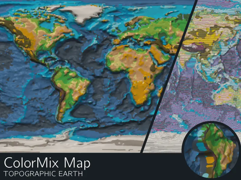
ColorMix Map: topographic earth
por FritzPeppone en Printables
A topographic relief map of earth in color using CMYWK or CMYW ColorMix
Licencia
Solo uso personalCC BY-NC-SA 4.0 — Atribución, no comercial, compartir igual
Uso personal dando crédito; sin fines comerciales y las modificaciones con la misma licencia.
Al descargar aceptas respetar la licencia y dar crédito a FritzPeppone.
Archivos (4)
- Categoría
- Educación
- Formatos
- STEP, F3D, 3MF
- Descargas
- 56
- Publicado
Sobre este modelo
My most ambitious model so far: a CMYWK ColorMix topographic relief map of Earth, available in two versions: CMYWK for 5-tool printers and CMYW for 4-tool printers. The CMYWK version uses 31 distinct colors, providing finer details, while the CMYW version uses 22 colors. Both versions represent different elevation and depth ranges, with physical relief that follows Earth's actual topography, including both land elevations and seafloor depths. All photos are from the 5T version. I recommend using Prusa CMYWK ColorMix filament, as the colors were selected using the Prusa FDM Mixer Playground with exactly these filaments. Other filaments will work too but the mixed colors may turn out differently. A simple multi-part frame with dovetail joints is also included. The map was test-printed by SecretRaindrop, who kindly allowed me to use their photos. All print photos, including the cover image, are courtesy of SecretRaindrop. Many thanks! Print Details - Map dimensions: 290 × 145 mm (just fits diagonally on the C1 INDX)
- Estimated print time: 1 day, 22 hours
- Estimated filament consumption: - Cyan (C): 134 g
- Magenta (M): 78 g
- Yellow (Y): 85 g
- White (W): 103 g
- Black (K): 65 g
- Total: approximately 466 g
- Filament order: CMYWK
- No supports required
Due to the huge number of filament changes, I only recommend printing this with a tool changer or nozzle changer printer with at least 5 tools such as the Prusa XL or the CORE One (L) + INDX. Files and Slicing Slicing may take a considerable amount of time due to the model's complexity and file size. The combined STL files total approximately 1.73 GB, while the 3MF file is around 400 MB. Only the 3MF file is provided: - Plate 1: Topographic map
- Plate 2: Multi-part frame
Remixing and other projects This model is generated using image data processed with Python Code. If you are interested in remixes or if you plan to start a similar project, feel free to message me. I'll happily share Fusion source files for the frame or the python code to generate the multicolor map. Changelog - 2026.10.11: initial upload
- 2026.10.12: correction of the filament order (from CMYKW to CMYWK)
- 2026.10.17: added print photos, courtesy of SecretRaindrop
- 2026.10.17: added a 4-toolhead version with "only" 22 colors in total
Descripción original del autor, publicada en Printables.